Settlement development in Vel'ké Pole, Píla and Radobica, Slovakia
Radobica
Agriculture change
Agriculture increase
Agriculture decrease
No changes
Border
Agriculture decrease
No changes
Border
Legend Layer
 |
Agriculture increase |
 |
Agriculture decrease |
 |
No changes |
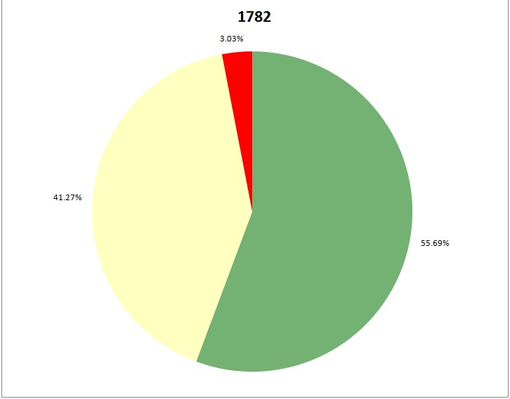
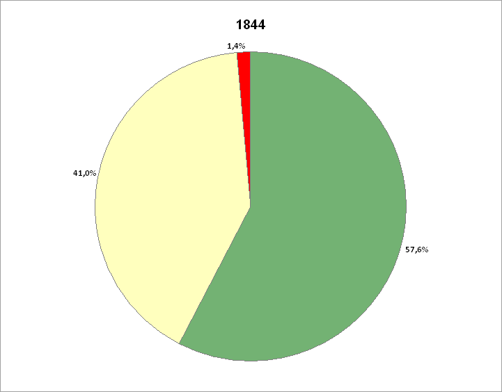
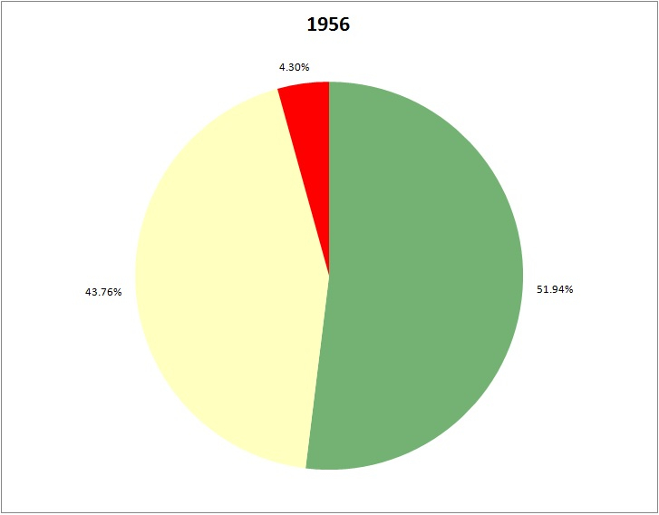
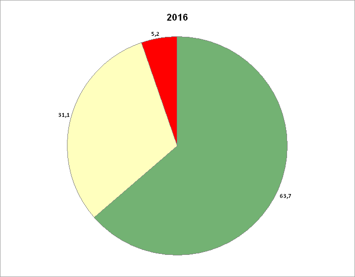
Development of the land use between 1782 and 2016:
Total area of the municipality: ca. 1145 ha
| 1782 | Change | 1844 | Change | 1956 | Change | 2016 | |||||
|---|---|---|---|---|---|---|---|---|---|---|---|
| Forest | 637.7 ha (55.69%) |
21.78 ha (1.91%) |
659.48 ha (57.60%) |
-64.75 ha (-5.66%) |
594.73 ha (51.94%) |
134.87 ha (11.78%) |
729.6 ha (63.72%) |
||||
| Agriculture | 472.58 ha 41.27%) |
-3.08 ha (-0.27%) |
469.5 ha (41% ) |
31.54 ha (43.76%) |
501.04 ha (43.76%) |
-144.89 ha (-12.66%) |
356.15 ha (31.10%) |
||||
| Settlement | 34.72 ha (3.03%) |
-18.7 ha (-1.63%) |
16.02 ha (1.40%) |
33.21 ha (2.90%) |
49.23 ha (4.30%) |
10.02 ha (4.30%) |
59.25 ha (5.18%) |
Percentages of the settlement, agriculture and forest areas: