Settlement development in Vel'ké Pole, Píla and Radobica, Slovakia
Píla
Agriculture change
Agriculture increase
Agriculture decrease
No changes
Border
Agriculture decrease
No changes
Border
Legend Layer
 |
Agriculture increase |
 |
Agriculture decrease |
 |
No changes |
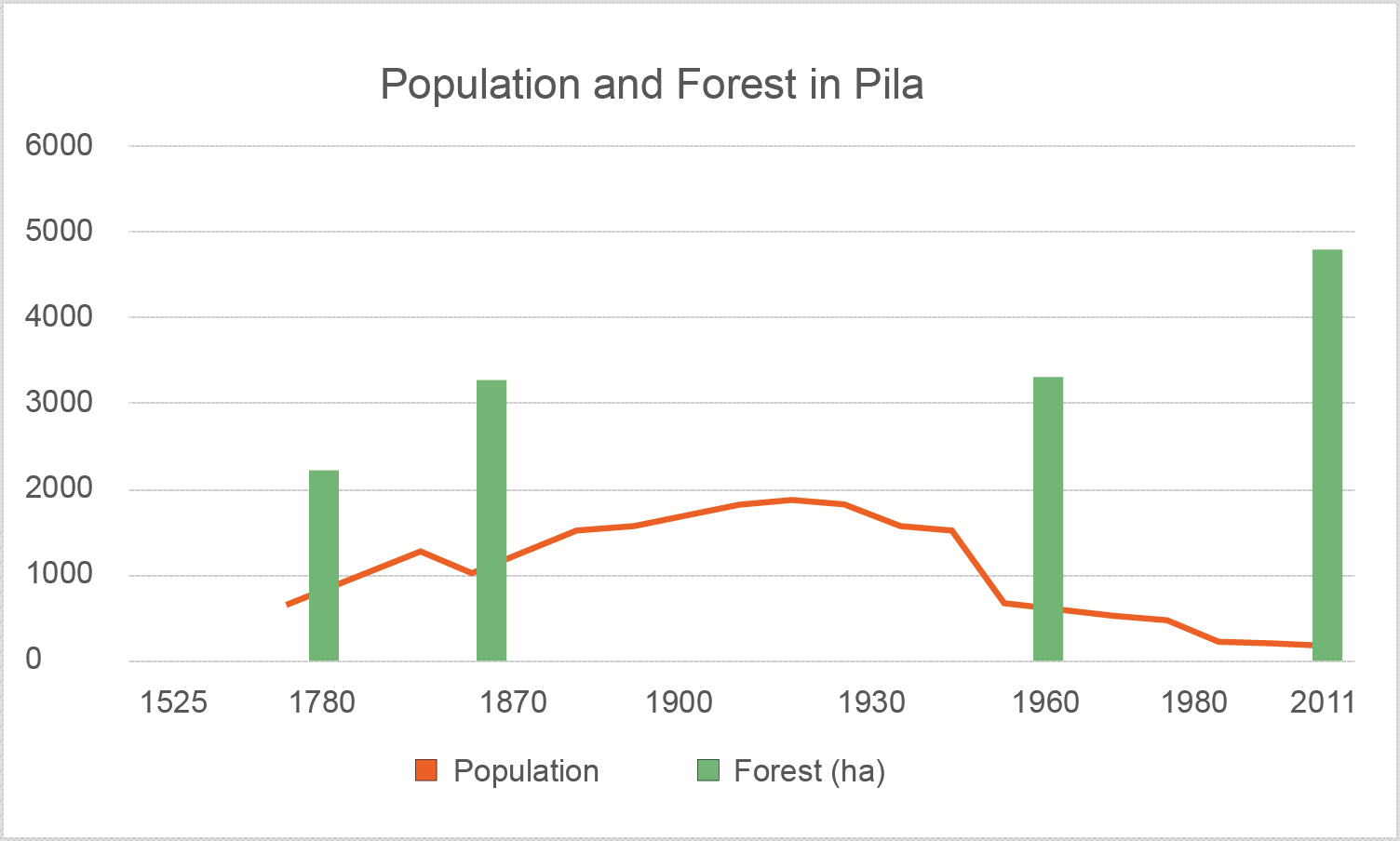
Development of the land use between 1782 and Today:
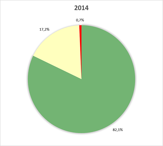
Total area of the municipality: ca. 2561 ha
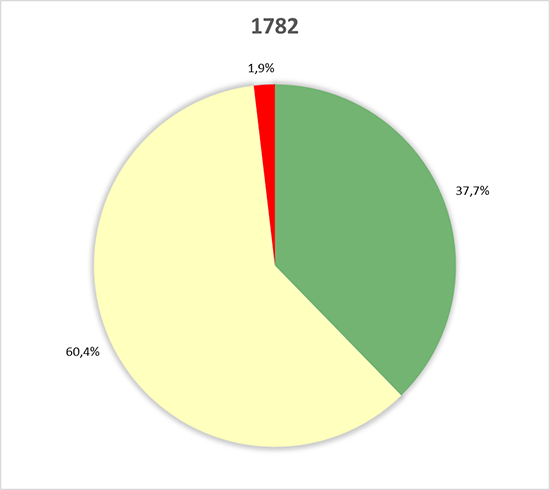
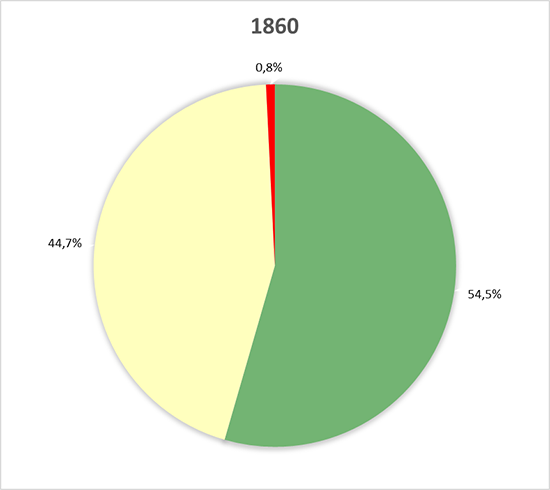
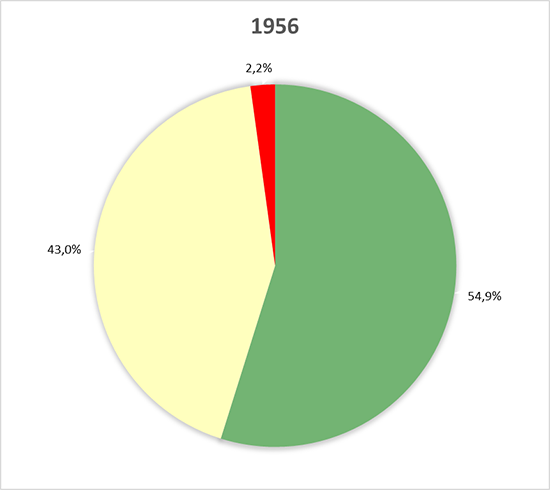
| 1782 | Change | 1860 | Change | 1956 | Change | 2014 | |||||
|---|---|---|---|---|---|---|---|---|---|---|---|
| Forest | 965.76 ha (37.71%) |
428.92 ha (16.77%) |
1,394.68 ha (54.48%) |
9.49 ha (0.37%) |
1404.17 ha (54.85%) |
698.63 ha (27.29%) |
2102.8 ha (82.14%) |
||||
| Agriculture | 1547.34 ha (60.42%) |
-401.02 ha (-15.68%) |
1146.32 ha (44.74%) |
-46.32 ha (-1.77%) |
1100 ha (42.97%) |
-658.97 ha (-25.78%) |
441.03 ha (17.19%) |
||||
| Settlement | 47.9 ha (1.87%) |
-27.9 ha (-1.09%) |
20 ha (0.78%) |
36.83 ha (1.40%) |
56.83 ha ( 2.18%) |
-39.66 ha (-1.51%) |
17.17 ha (0.67%) |
Percentages of the settlement, agriculture and forest areas:

Land use change between 1782-1860