Settlement development in Vel'ké Pole, Píla and Radobica, Slovakia
Vel'ké Pole
Agriculture change
Agriculture increase
Agriculture decrease
No changes
Border
Agriculture decrease
No changes
Border
Legend Layer
 |
Agriculture increase |
 |
Agriculture decrease |
 |
No changes |
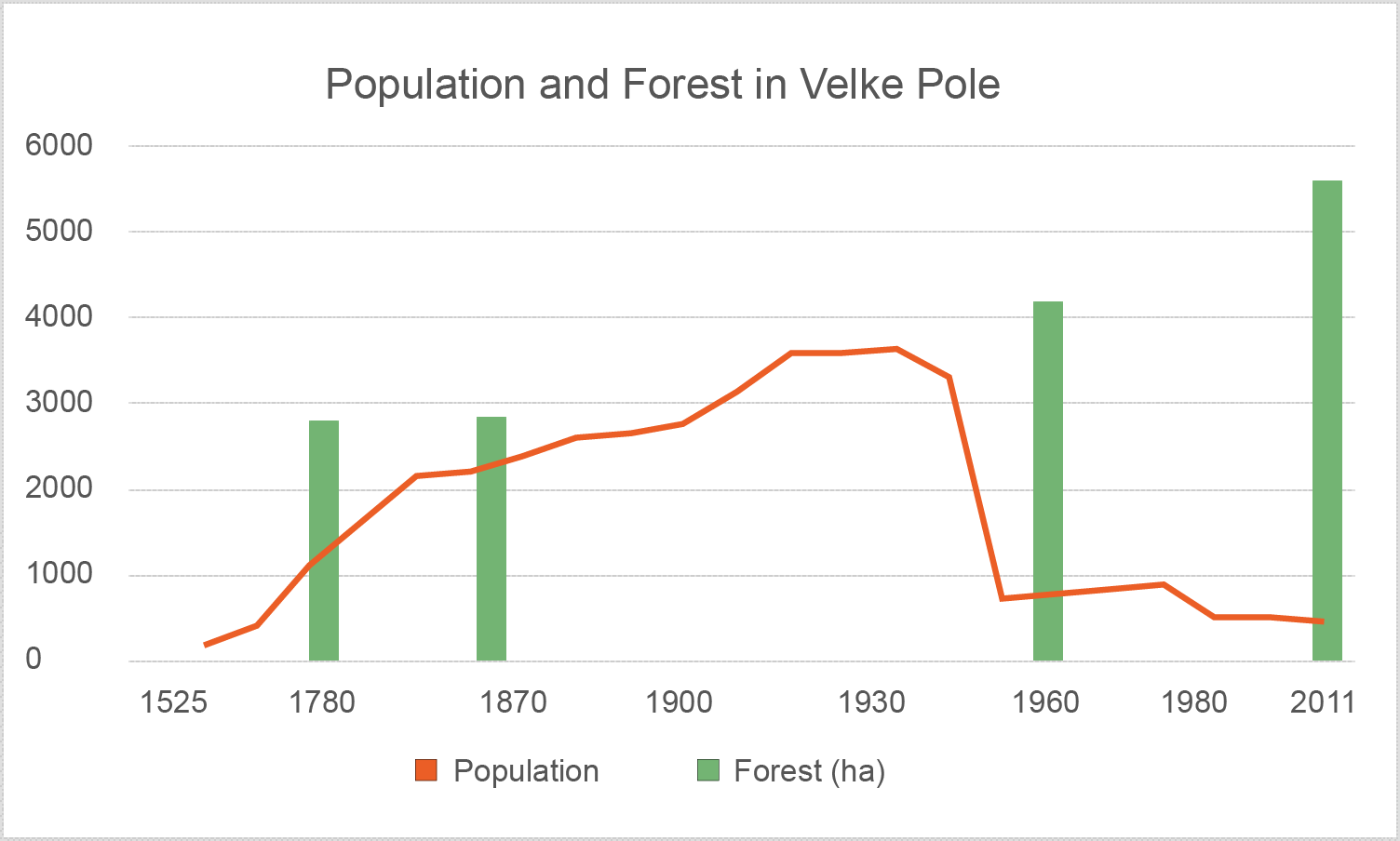
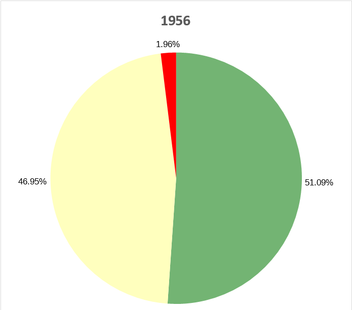
Development of the land use between 1782 and Today:
Total area of the municipality: ca. 3560 ha
| 1782 | Change | 1860 | Change | 1956 | Change | 2014 | |||||
|---|---|---|---|---|---|---|---|---|---|---|---|
| Forest | 2783,39 ha (34,01%) |
675,29 ha (8,72%) |
3458,48 ha (42,73%) |
720,81 ha (8,36%) |
4179,29 ha (51,09%) |
1400,40 ha (17,12%) |
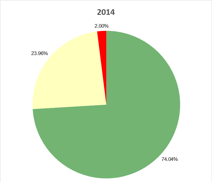
5579,69 ha (68,21%%) |
||||
| Agriculture | 5025,83 ha (63,61%) |
-674,44 ha (-7.63%) |
4531,39 ha (55,98%) |
-690,65 ha (-9,03%) |
3840,74 ha (46,95%) |
-1481,76 ha (-18,11%) |
2358,98 ha (28,84%) |
||||
| Settlement | 195,45 ha (2,39%) |
-90,77 ha (-1,09%) |
104,68 ha (1,29%) |
55,73 ha (0,67%) |
160,41 ha (1,96%) |
81,35 ha (1,00%) |
241,76 ha (2,96%) |
Percentages of the settlement, agriculture and forest areas:
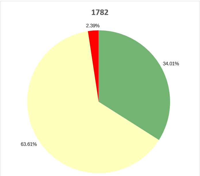
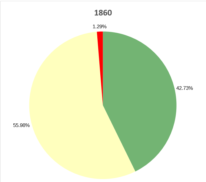

Land use change between 1782-1860