Settlement development in Vel'ké Pole, Píla and Radobica, Slovakia
Vel'ké Pole, Píla and Radobica
Agriculture change
Agriculture increase
Agriculture decrease
No changes
Border
Agriculture decrease
No changes
Border
Legend Layer
 |
Agriculture increase |
 |
Agriculture decrease |
 |
No changes |
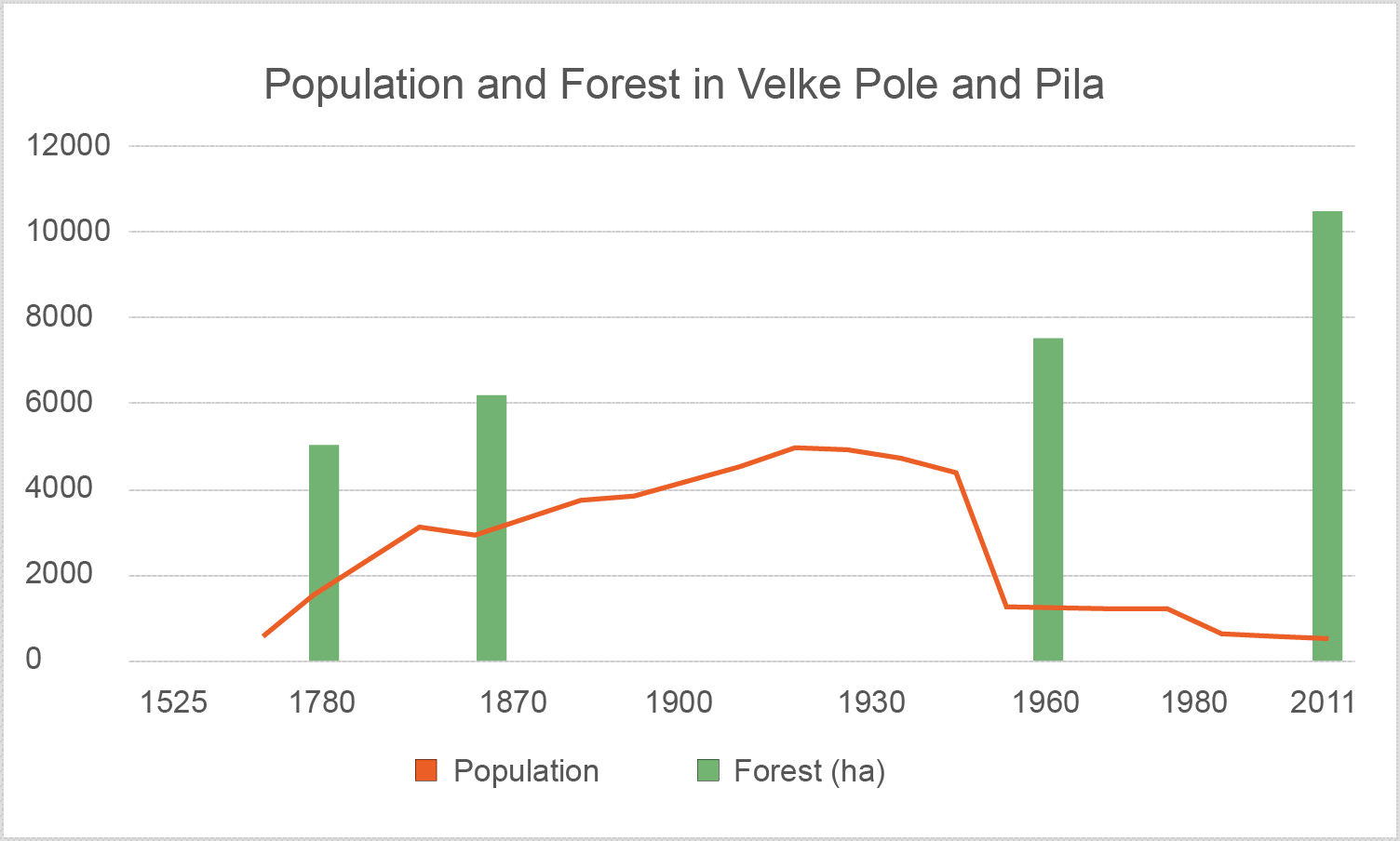
Development of the land use between 1782 and Today:
Total area of the municipality: ca. 7267 ha
| 1782 | Change | 1844/60 | Change | 1956 | Change | Today | |||||
|---|---|---|---|---|---|---|---|---|---|---|---|
| Forest | 5640.16 ha (37.07%) |
1682.70 ha (11.35%) |
7322.86 ha (48.42%) |
677.88 ha (3.08%) |
8000.74 ha (52.61%) |
3140.71 ha (56.19%) |
11141.45 ha (73.26%) |
||||
| Agriculture | 9234.15 ha (60.69%) |
-1601.37 ha (-10.22%) |
7632.78 ha (50.47%) |
-763.45 ha (-8.05%) |
6869.33 ha (45.17%) |
-3143.03 ha (-56.54%) |
3726.30 ha (24.50%) |
||||
| Settlement | 340.24 ha (2.24%) |
-173.62 ha (-1.13%) |
166.62 ha (1.10%) |
171.46 ha (4.97%) |
338.08 ha (2.22%) |
2.30 ha (0.36%) |
340.38 ha (2.24%) |
Percentages of the settlement, agriculture and forest areas:
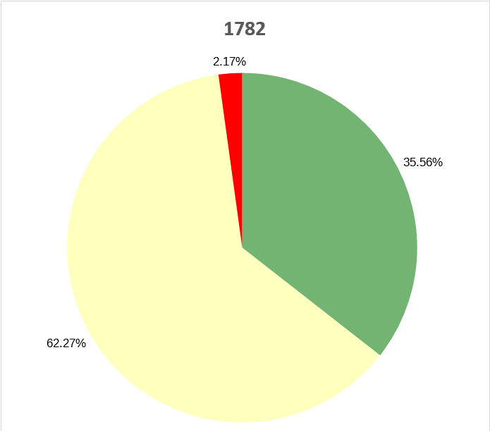
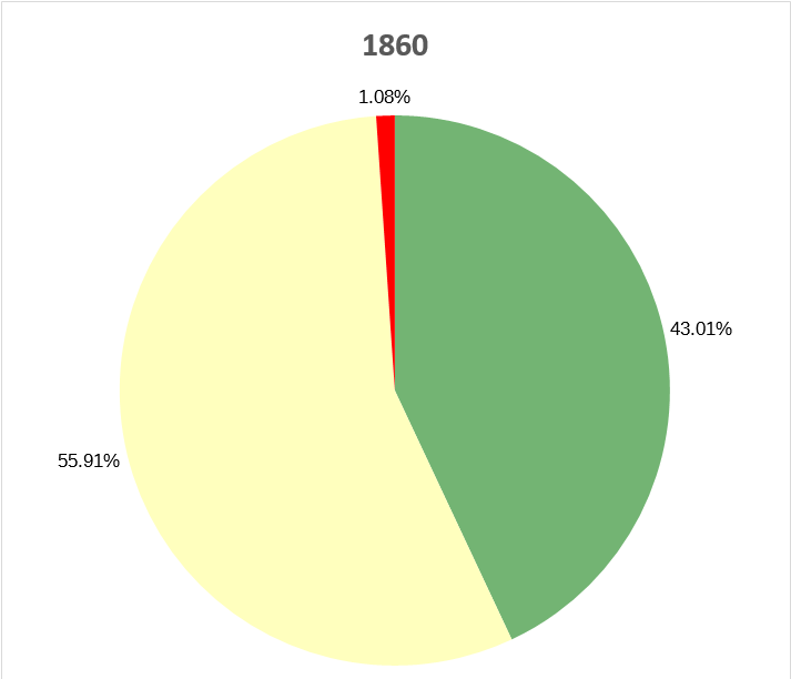
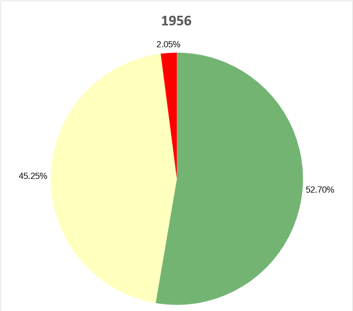

Land use change between 1782-1860